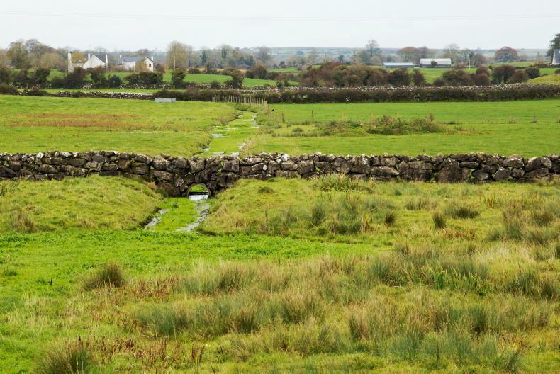
The much-talked about GAEC 2, or the good agricultural environmental condition for the protection of wetlands and peatlands, was approved and adopted by the European Commission on 30 April 2025.
In announcing the commencement of GAEC 2, the Department of Agriculture stated that the introduction of GAEC 2 was mandatory for all member states as per European Union regulations and that “its objective is to protect wetlands and peatlands – high carbon soils”.
It added that “the standard provides for a baseline protection for carbon rich soils, while allowing agricultural activity to continue. For example, “normal” ploughing, reseeding and maintenance of existing drains is allowed. New drainage is also possible in line with the existing national planning provisions”.
What are the requirements
for GAEC 2?
The requirements for protecting GAEC 2 soils and conditions for farming such lands are outlined by the Department as follows:
1. Maintenance and repair of existing drains is allowed as long as drains are not deepened nor is there an extension of the drained area beyond what previously existed, otherwise this will be considered new drainage.2. New drainage will be subject to planning permission requirements, as is currently the case under national planning legislation.3. Shallow ploughing up to 30cm depth may take place annually for arable crops, but for grassland rejuvenation of permanent grassland, ploughing must not take place more frequently than once in every four years. Deep ploughing greater than 30cm depth for grassland or arable crops is not allowed.Day-to-day impact
The Department of Agriculture asserts that the GAEC 2 standard is expected to have minimal effect on most farmer’s day to day operations.
“Our grass-based system already provides considerable protection for such soils, and they are also protected by existing national planning provisions, for example on drainage. Maintenance of existing drainage may continue on these lands, while new drainage may take place subject to national planning provisions as currently is the case. Maintenance of existing drains includes the replacement of old drains or drains that have ceased to function over time.
“Since shallow ploughing (up to 30cm), and reseeding through ploughing (one in four years) is allowed under GAEC 2, these provisions are expected to have minimal impact, as they are considered as ‘typical’ practices on Irish farms. Other reseeding methods, such as discing or direct drilling, can take place more frequently if the beneficiary wants”.
It was also highlighted that it is important to note these new conditions under GAEC 2 do not supersede any obligations that a farmer already has around the land parcels arising from land designation under Special Protection Area (SPA) or Special Areas of Conservation (SACs). If a farmer already needs consent from the National Parks and Wildlife (NPWS) for activities on a GAEC 2 parcel, then that remains that case.
Farmers concerned
Farmers who make applications for area-based payments under the Common Agricultural Policy (CAP) via the Basic Income Support for Sustainability (BISS) are subject to conditionality requirements. The Department reports it is in the process of writing to farmers whose lands are now subject to GAEC 2 rules. Land parcels subject to GAEC 2 can also be viewed on Agfood.ie as outlined in the column below.
Approximately one third of farmers (42,000) will have some land that is subject to the standard, but those holdings with less than 10 ha (approximately 7,000) will not be subject to specific conditionality controls or penalties.
An appeals system will be available for any farmers who believe their parcels have been misclassified as GAEC 2. However, the Department outlines that this will be “only where the farmer needs to carry out essential new drainage works or derogate from the other requirements”.
In certain circumstances, it will also be possible for farmers to split a parcel into the “peat soil” and “non-peat soil” components. Details of the appeals process will be set out in due course.
Identifying peat soils
A land parcel can have an area of peat soil but not be subject to GAEC 2. This is as parcels with areas of 50% or more peat soils are determined as applicable to GAEC 2.
Peat soils are mapped in the Teagasc-EPA soils and subsoils map and such maps were derived using the following definition: “A peat soil is defined as organic soil materials which have sedentarily accumulated and have at least 30% (dry mass) organic matter over a depth of at least 45cm on undrained land and 30cm deep on drained land; the depth requirement does not apply if the peat layer is over bedrock.”
There are two ways of identifying peat soils outside of waiting from the notification letter from the Department of Agriculture. Both are via the agfood.ie facility and the BISS application system, and can be accessed by a farmer or their adviser.
In the ‘land details’ section of the BISS application system the specific parcels subject to GAEC 2 can be checked in the ‘Parcel No./Plot Ref’ column. In this column, any parcels which are determined to be GAEC 2 parcels will have the “%” symbol displayed after the relevant parcel number.
The actual peat soil layer can be viewed on a map on the LPIS mapping system. The layer can be found through the following flow of access layers:
Layers. Reference layers. EPA. EPA soils. Teagasc-EPA Indicative Soils OM Map >=30% OM=>Reference Layers.This ‘Teagasc-EPA Indicative Soil OM Map >=30% layer’ can be toggled on and viewed by selecting the relevant buttons and clicking on the ‘update’ tab.


SHARING OPTIONS