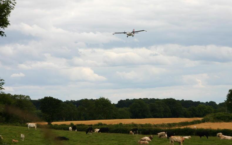
Kerry farmers, have you seen a low-flying plane across the sky this summer? Maybe even those of you in parts of Cork and Limerick too?
If so, it’s likely it was conducting the Tellus survey on behalf of Geological Survey Ireland (GSI), a division of the Department of Environment.
This work is ongoing. So in Kerry, parts of north and west Cork, as well as some of west Limerick, keep an eye on the sky.

GSI and Tellus project manager Dr Jim Hodgson.
What is the Tellus survey, though?
Well, essentially it’s a tool for geologically mapping Ireland’s land. Using different scientific instruments on a plane, it collects geochemical and geophysical data on rocks, soil and water across the country.
The survey began 13 years ago in the border region as a collaborative effort between the geological survey bodies of both the Republic of Ireland and Northern Ireland.
In the intervening years, it has expanded with the goal of mapping the whole island of Ireland. The survey is conducted in blocks, not strictly along county bounds.
Alongside the airborne survey, soil samples were also taken. This was completed for the whole island in early August, with the last samples taken in Cork.
Ireland is now one of the first countries in the world to complete detailed geochemical national soil sampling, with the first samples taken in the border region in 2011.
The Tellus survey is currently being conducted in Kerry, as well as parts of Cork and Limerick.
Output
The result of the survey is a range of maps, which are made available on gsi.ie.
Each block is like a jigsaw piece. They are put together, eventually making a whole map of Ireland.
The data from the airborne survey usually takes about six months from the date they finish flying before it is available. Soil sampling results take longer, up to two years.
The plane that gathers the data flies in a grid pattern, up and down straight lines, spaced about 200m apart.
The plane flies in a grid pattern, up and down straight lines spaced about 200m apart.
A block is done across the summer months and into the autumn each year. The block currently being done in Kerry and the surrounding areas is the second last to be flown. The remaining block will be completed next summer in Clare.
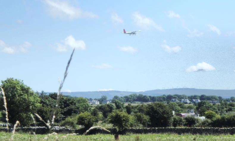
In 2024, the survey plane is based at Shannon Airport. The flying and data collection is being carried out by a specialist Canadian company.
The plane flies at 60m over rural areas – about eight times the height of a two-storey house – and 240m over urban areas. This height, alongside each day’s flight paths, are approved by the Irish Aviation Authority (IAA).
Data collection
GSI and Tellus project manager Dr Jim Hodgson, explains that as the plane flies three different types of data are collected via three different instruments. These include data on the Earth’s magnetic field, soil and rock conductivity and a radiometric survey.
Using these tools gives more accurate results than historical land mapping tools.
“One instrument is a magnetometer, that measures variations of the Earth’s magnetic field. That’s really useful because different rocks have different magnetic properties and we can use that to do a really detailed mapping of the geology.
“Traditionally, when geological maps were created, it was people walking across fields. They’d find a rock outcrop, then they’d walk across the field and might find another rock outcrop 100m away,” Hodgson says.
It is envisioned that the block should take about five months to complete. The current Kerry block started at the end of May. That said, much like farming, it is very weather-dependent.
The plane can’t fly while it is raining or when it is very windy, Hodgson explains.
“The instruments, they’re affected by the rain; when we’re taking the conductivity measurements, the data gets all scrambled. So there’s no point flying when it’s raining.
“Then, because they’re flying along these pre-derived lines, if the wind is too strong it blows them off the line and we basically would then tell them to fly the line again.
“Equally from a low cloud point of view, they may need to make sure they have good enough visibility. So it’s just purely from a health and safety point of view that they don’t fly if it’s too windy or if it’s too cloudy.
“It can take us a long time. Sometimes we’re sitting on the tarmac for a week waiting for the weather to improve, but we just have to be patient and we get there in the end,” he says.
When the weather is cooperating and clear, they try to fly over high ground where visibility may be impacted on other days.
Farm level implications
And what exactly has this got to do with farmers?
Everything and nothing, Hodgson explains.
“When we started, it was a geo-environmental and geological project. It wasn’t envisioned as an agricultural survey.
“However, as we’ve made the data available, other people have said, ‘actually, this is really useful for soil scientists and agricultural scientists,’” he adds.
For example, GSI partnered with Teagasc in 2018 on the five-year Terra soil project, which provided agri-environmental soil data.

The block that is currently being flown as part of the Tellus survey.
Data collection
So what impact will the maps have on farming? Could they potentially inform future CAPs, the Irish Farmers Journal asks?
Hodgson doesn’t think so.
“We’re a national and regional scale survey, we’re not doing it on a farm scale. We’re not going to replace that need to do individual farm studies.
“We might, from the data we collect, say the soil in this area has low copper or high zinc, whatever the case may be, but it’s just giving you a regional picture,” he says.
That said, the data will inform the policies of some important State departments and bodies.
“A lot of the information we will be collecting will feed into Teagasc, the Department of Agriculture, the National Parks and Wildlife Service (NPWS), the Environmental Protection Agency (EPA), there’s lots of people actually involved within that.
“The more information, the better understanding we have. We won’t be writing policy based on the soil, for example, but our data will be feeding into that,” Hodgson explains.
The head of the project adds that individual farms or parcels of land cannot be easily picked out from the maps
“We’re not actually saying, ‘Oh, this farmer has high levels of that.’ The maps are scaled, so you can’t actually see the exact locations. We do that deliberately. You’re not giving the locations of people that own the land,” he says.
However, you can search by Eircode.
No photographs are taken during the flight, Hodgson says.
There is a video, akin to a dash cam, but this is only in case of emergency and not stored.
Peat mapping
Interestingly, the data may also inform a topic which has been quite controversial among farmers in recent months – rewetting.
One of the instruments on the plane measures gamma rays. Due to the water in peat soils, gamma rays are not emitted.
This allows for a detailed mapping of peat soils, which GSI has been working on with the University of Galway and Teagasc.
“Not everywhere might be suitable for being rewet. Obviously, if you have a better understanding of how much peat you have - the thickness of the peat, if you have mineral soils and peat underneath - this is going to change how you make those decisions.
“The more information we have about the subsurface, the better decisions; whether it’s suitable for it to be rewet, it might or might not be, and that’s probably for someone else to decide,” Hodgson explains.
When is the plane in my area?
As mentioned, the Kerry block with parts of Cork and a small bit of Limerick, is currently being flown.
The map shows what sections have been done and what is planned for this week. This information is updated on gsi.ie.
You can be notified when the plane is flying over your house or land. Some do this due to having sensitive livestock, others because they want to see the plane. This can be done by calling the Tellus freephone information line on 1800 45 55 65.
In short
The Tellus survey is currently being conducted by a low-flying plane across Kerry, as well as parts of Cork and Limerick. This plane collects geological data via scientific instruments. The output of the survey is a range of maps. These maps may inform bodies that shape agricultural policy. Farmers can be notified of when the plane is flying over their land.
Kerry farmers, have you seen a low-flying plane across the sky this summer? Maybe even those of you in parts of Cork and Limerick too?
If so, it’s likely it was conducting the Tellus survey on behalf of Geological Survey Ireland (GSI), a division of the Department of Environment.
This work is ongoing. So in Kerry, parts of north and west Cork, as well as some of west Limerick, keep an eye on the sky.
GSI and Tellus project manager Dr Jim Hodgson.
What is the Tellus survey, though?
Well, essentially it’s a tool for geologically mapping Ireland’s land. Using different scientific instruments on a plane, it collects geochemical and geophysical data on rocks, soil and water across the country.
The survey began 13 years ago in the border region as a collaborative effort between the geological survey bodies of both the Republic of Ireland and Northern Ireland.
In the intervening years, it has expanded with the goal of mapping the whole island of Ireland. The survey is conducted in blocks, not strictly along county bounds.
Alongside the airborne survey, soil samples were also taken. This was completed for the whole island in early August, with the last samples taken in Cork.
Ireland is now one of the first countries in the world to complete detailed geochemical national soil sampling, with the first samples taken in the border region in 2011.
The Tellus survey is currently being conducted in Kerry, as well as parts of Cork and Limerick.
Output
The result of the survey is a range of maps, which are made available on gsi.ie.
Each block is like a jigsaw piece. They are put together, eventually making a whole map of Ireland.
The data from the airborne survey usually takes about six months from the date they finish flying before it is available. Soil sampling results take longer, up to two years.
The plane that gathers the data flies in a grid pattern, up and down straight lines, spaced about 200m apart.
The plane flies in a grid pattern, up and down straight lines spaced about 200m apart.
A block is done across the summer months and into the autumn each year. The block currently being done in Kerry and the surrounding areas is the second last to be flown. The remaining block will be completed next summer in Clare.
In 2024, the survey plane is based at Shannon Airport. The flying and data collection is being carried out by a specialist Canadian company.
The plane flies at 60m over rural areas – about eight times the height of a two-storey house – and 240m over urban areas. This height, alongside each day’s flight paths, are approved by the Irish Aviation Authority (IAA).
Data collection
GSI and Tellus project manager Dr Jim Hodgson, explains that as the plane flies three different types of data are collected via three different instruments. These include data on the Earth’s magnetic field, soil and rock conductivity and a radiometric survey.
Using these tools gives more accurate results than historical land mapping tools.
“One instrument is a magnetometer, that measures variations of the Earth’s magnetic field. That’s really useful because different rocks have different magnetic properties and we can use that to do a really detailed mapping of the geology.
“Traditionally, when geological maps were created, it was people walking across fields. They’d find a rock outcrop, then they’d walk across the field and might find another rock outcrop 100m away,” Hodgson says.
It is envisioned that the block should take about five months to complete. The current Kerry block started at the end of May. That said, much like farming, it is very weather-dependent.
The plane can’t fly while it is raining or when it is very windy, Hodgson explains.
“The instruments, they’re affected by the rain; when we’re taking the conductivity measurements, the data gets all scrambled. So there’s no point flying when it’s raining.
“Then, because they’re flying along these pre-derived lines, if the wind is too strong it blows them off the line and we basically would then tell them to fly the line again.
“Equally from a low cloud point of view, they may need to make sure they have good enough visibility. So it’s just purely from a health and safety point of view that they don’t fly if it’s too windy or if it’s too cloudy.
“It can take us a long time. Sometimes we’re sitting on the tarmac for a week waiting for the weather to improve, but we just have to be patient and we get there in the end,” he says.
When the weather is cooperating and clear, they try to fly over high ground where visibility may be impacted on other days.
Farm level implications
And what exactly has this got to do with farmers?
Everything and nothing, Hodgson explains.
“When we started, it was a geo-environmental and geological project. It wasn’t envisioned as an agricultural survey.
“However, as we’ve made the data available, other people have said, ‘actually, this is really useful for soil scientists and agricultural scientists,’” he adds.
For example, GSI partnered with Teagasc in 2018 on the five-year Terra soil project, which provided agri-environmental soil data.
The block that is currently being flown as part of the Tellus survey.
Data collection
So what impact will the maps have on farming? Could they potentially inform future CAPs, the Irish Farmers Journal asks?
Hodgson doesn’t think so.
“We’re a national and regional scale survey, we’re not doing it on a farm scale. We’re not going to replace that need to do individual farm studies.
“We might, from the data we collect, say the soil in this area has low copper or high zinc, whatever the case may be, but it’s just giving you a regional picture,” he says.
That said, the data will inform the policies of some important State departments and bodies.
“A lot of the information we will be collecting will feed into Teagasc, the Department of Agriculture, the National Parks and Wildlife Service (NPWS), the Environmental Protection Agency (EPA), there’s lots of people actually involved within that.
“The more information, the better understanding we have. We won’t be writing policy based on the soil, for example, but our data will be feeding into that,” Hodgson explains.
The head of the project adds that individual farms or parcels of land cannot be easily picked out from the maps
“We’re not actually saying, ‘Oh, this farmer has high levels of that.’ The maps are scaled, so you can’t actually see the exact locations. We do that deliberately. You’re not giving the locations of people that own the land,” he says.
However, you can search by Eircode.
No photographs are taken during the flight, Hodgson says.
There is a video, akin to a dash cam, but this is only in case of emergency and not stored.
Peat mapping
Interestingly, the data may also inform a topic which has been quite controversial among farmers in recent months – rewetting.
One of the instruments on the plane measures gamma rays. Due to the water in peat soils, gamma rays are not emitted.
This allows for a detailed mapping of peat soils, which GSI has been working on with the University of Galway and Teagasc.
“Not everywhere might be suitable for being rewet. Obviously, if you have a better understanding of how much peat you have - the thickness of the peat, if you have mineral soils and peat underneath - this is going to change how you make those decisions.
“The more information we have about the subsurface, the better decisions; whether it’s suitable for it to be rewet, it might or might not be, and that’s probably for someone else to decide,” Hodgson explains.
When is the plane in my area?
As mentioned, the Kerry block with parts of Cork and a small bit of Limerick, is currently being flown.
The map shows what sections have been done and what is planned for this week. This information is updated on gsi.ie.
You can be notified when the plane is flying over your house or land. Some do this due to having sensitive livestock, others because they want to see the plane. This can be done by calling the Tellus freephone information line on 1800 45 55 65.
In short
The Tellus survey is currently being conducted by a low-flying plane across Kerry, as well as parts of Cork and Limerick. This plane collects geological data via scientific instruments. The output of the survey is a range of maps. These maps may inform bodies that shape agricultural policy. Farmers can be notified of when the plane is flying over their land. 


 This is a subscriber-only article


SHARING OPTIONS: